SDG 6 Power Solutions

  • Discover resources to help you explore SDG issues
  • Figure out which water issue to solve in your community
  • Learn about other people and organizations working on clean water
  • See some existing solutions to inspire you
  • Get ideas and templates to take your solutions to the next level

There are no activities in this lesson.

SDG 6 POWER SOLUTION

Let’s follow the journey of Laura, a Technovation alumna who created an app around the problem of clean water and SDG 6.

Laura Mendes

Laura Mendes, 19 years old, is a calm girl with a strong Brazilian expression running through her veins. She loves the sunset, beach, and painting canvasses. She is currently a student at Instituto Federal de Pernambuco in Brazil. In 2022, she represented LALA – Latine American Leadership Academy at the Wellbeing Project Summit in Bilbao, Spain. She has mentored several international Technovation teams. Laura possesses an intense desire to grow and use her knowledge to impact people.

Click on the tabs below to learn about each part of the process Laura used to create her app, called Dropin’.

Laura’s app targets water pollution.

The general idea is to highlight protected water areas around the world.

The app also allows users to locate both clean and polluted water areas near them.

app functions
dropin splash screen
Splash screen
dropin logo designs
Logo designs
dropin screen designs
Screen designs

Listen to Laura talk about different aspects of her project. Click on each question to hear what she has to say.

tutorial for dropin app screenshot

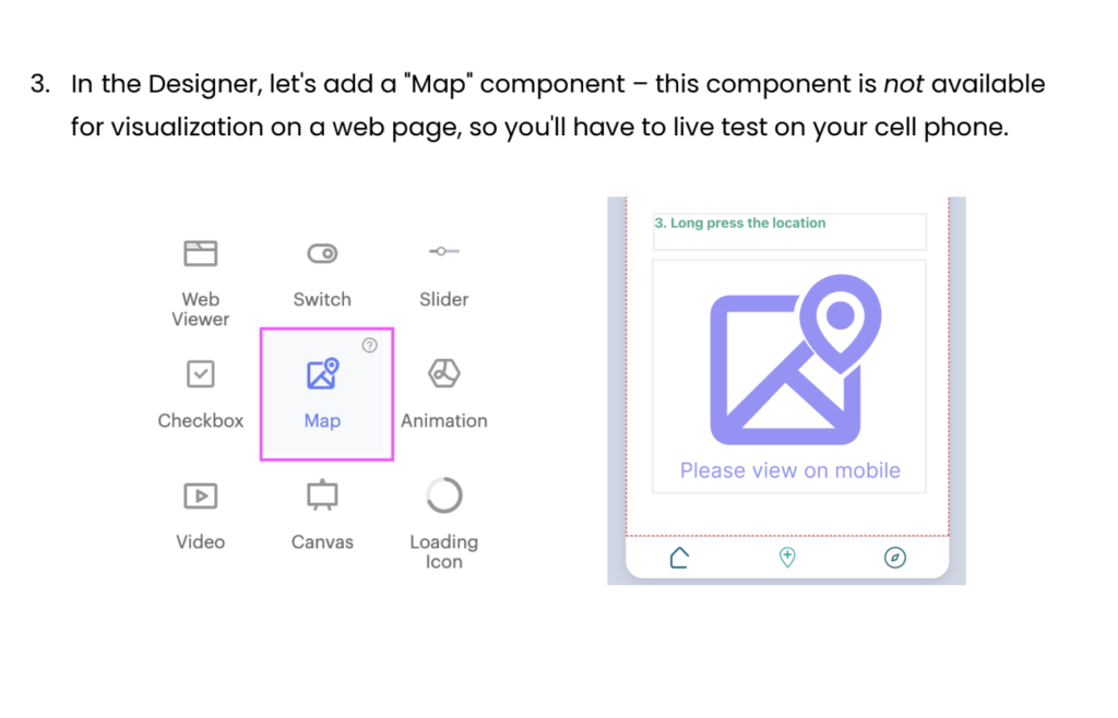
Laura shows you how to use Google Sheets and Map/Marker components to display location-based information in your app. Her app displays markers for polluted and clean water sites, crowdsources by app users.

OTHER SOLUTIONS

Here are a few more solutions to spark ideas for you for SDG 6. Click each tab to see some possible features and what coding components you could use to build a similar app.

LOO LOCATOR APP

Click on each image below to see a possible feature and how you might implement it.

gmap
Based on your location, the app will tell you where the closest public toilets are.
You can use the Map and Location Sensor components, and either an API, or cloud database to look up the information to be reported.
network-5508173_640
Helps you advocate for public toilet facilities in your community.
You could use a cloud database of government departments to contact and templates for email or letters to send. There might also be APIs available for contacting politicians based on your address.

NO WATER WASTE APP

Click on each image below to see a possible feature and how you might implement it.
image stack
Users share tips and tricks they use to save water.
You can use the Camera and cloud storage so users of the app can create a post with text and an image (or possibly video) to share.
information icon
Provide general educational information on water use and water inefficiency around the world
Depending on how you want to display the information, you can use Labels, Images and Videos in some type of Layout Arrangement to convey the information to users.
gmap
Based on your location, provide local information on ways to save water, such as replacing lawns with native plantings.
You can use cloud storage to store the locally-based information, and display the pertinent information by determining the user’s location, using a Location Sensor .
three-dots-calculator-screenshot
Help users calculate their current water use and potential savings
You could use Textboxes to allow users to enter information on their daily water use (showers, appliances, etc). You could then calculate possibly savings based on a % reduction in their water use. You could also let users track their daily use with Local Storage and update and reward them for saving water over time.

ALGAE BLOOM IDENTIFIER APP

Click on each image below to see a possible feature and how you might implement it.

image stack
Train an AI model on images of waterways with algae bloom
You can use an external AI platform to train the model with images of algae blooms (from space, scientists). The model would predict if a body of water had algae bloom or was clear.
camera illustration
Identify dangerous algae blooms based on user input of images
Users could take pictures with the Camera or input pictures of waterways and water bodies with the ImagePicker. Using the AI model, the app would predict a positive or negative appearance of algae.
bell-jar-1096280_640
Push notifications to users when there are algae blooms in waterways located near them
You can use the Clock, Alert, and/or Push Notification to let users know of algae bloom appearance in their area, based on their location, using a Location Sensor. You could also display all identified algae blooms using a Map.
information icon
Provide information about the dangers of algae blooms and ways to prevent them
You can use Labels to display the information to users.